HOME
SUBJECT
NEW YORK MAPS
NAVIGATION
Home
About
Help
View Cart
Explore the Collection
Artists
Featured Categories
Subjects |
View All
New York Maps
New York City Maps
Refine by style
Cartography
Early 20th Century
New York Maps
32 Items Found | Page 2 of 2
PREV
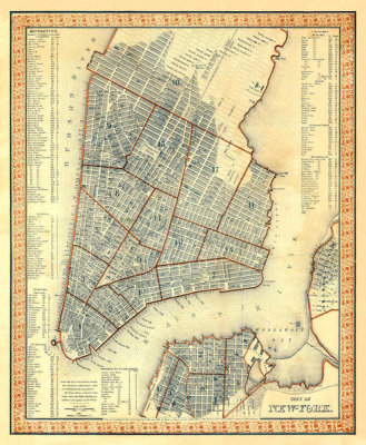
Samuel Augustus Mitchell
City of New York, 1846
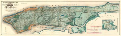
Egbert L. Viele
Sanitary & Topographical Map of the City and Island of New York, 1865
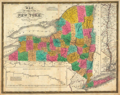
Samuel Augustus Mitchell
State of New York, 1831
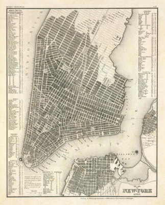
Society for the Diffusion of Useful Knowledge
New York, Plan, 1844
Matthew Dripps
City and County of New York North of 50th St., 1851
Society for the Diffusion of Useful Knowledge
New York, NY, 1840
Sidney E. Morse
New York, 1845
Henry S. Tanner
New York, 1825